
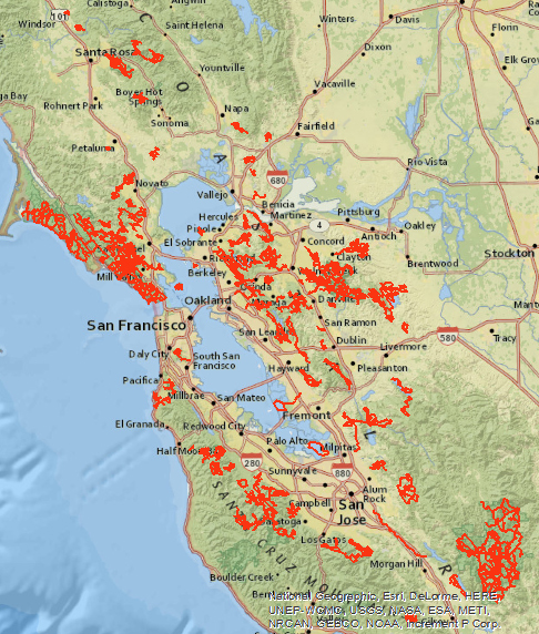
After moving back to the San Francisco Bay Area in 1997 I discovered the Bay Area Ridge Trail, which took about a calendar year to weekend hike the 250 mile loop in sections.
Over the years I continued to hike all the rest of the trail systems linking to the ridge trail, increasing my annual miles from 250 a year to 300, then 350, surpassing a bit more every year until I peaked
out in 2011 with 380 miles of day hikes. After adding backpacking to the mix, I hit 422 miles in 2018! Now that I'm retired, I nailed 490 trail miles in 2019. Let's see if I pass 500 in 2020.
|
|
|
|
|
|
|
|
|
About the Routes: Heads-up digitized in 2006-2007 from various regional park maps and commercial trail maps, using 2 meter aerial photography, USGS quad sheets, Tele-Atlas and GDT road data, and field verified the existence and connectivity of the trails by walking them.
Individual arcs are not named by trail. The name field represents a single day hike with an arbitrary name. The label field is a concatenation of name and miles.
Mileage figure is based on arc length. In the original geodatabase the arcs are classified by 1 for loops and traverses, and 2 for in-out trails, multiplied accordingly, and summarized and dissolved in the final KMZ file.
Back |